

Photo: Drew Tarvin, CC BY 2.0, cropped
Things to Do
Hiking & Nature Trail Guides
Rainforest, ridges and boardwalks: Singapore's best walks and hikes, rated by distance and difficulty.
Hiking in Singapore is closer than most visitors expect. Rainforest trails, hill parks and coastal boardwalks sit within easy reach of the city. This page collects our guides to the best walks and hikes.
Below the list, our guide compares the main trails by length and difficulty. It also covers how to choose a route and how to stay safe in the heat.
Plan it with EatStays: Nature & Parks.
New guides are on the way. Browse Things to Do →
What hiking in Singapore is like
Hiking in Singapore means short, well-marked trails rather than long mountain treks. The island is fairly flat, and its highest hill is only about 164 metres high. Even so, the heat and humidity make easy walks tiring. Most trails are a short bus or taxi ride from the city. Many have boardwalks, signs and toilets near the start.
Expect rainforest, mangroves, reservoirs and coastal paths. Long-tailed macaques, monitor lizards and many kinds of birds are common sights.
Best trails and nature walks
MacRitchie TreeTop Walk
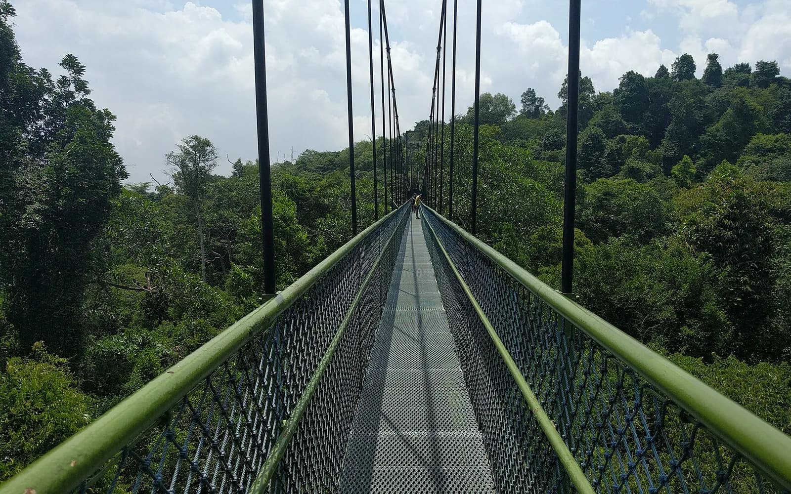
The MacRitchie TreeTop Walk is a suspension bridge high above the forest canopy. It sits inside the Central Catchment Nature Reserve. You reach it by forest trail from MacRitchie Reservoir, and the full loop is long. Allow three to four hours. Difficulty: moderate, mainly because of the distance.
Bukit Timah Nature Reserve
Bukit Timah Nature Reserve covers Singapore's highest hill and protects some of its oldest rainforest. The main path to the summit is short but steep. Other trails are rougher, with roots and steps. Close by, Dairy Farm Nature Park has quieter forest trails. Difficulty: short but steep.
Southern Ridges and Henderson Waves
The Southern Ridges and Henderson Waves trail links a chain of hill parks over about 10 kilometres. Highlights include Henderson Waves, a wave-shaped footbridge, and raised walkways through the trees. Many walkers start near HarbourFront MRT station and climb Mount Faber Park. The route continues west to Kent Ridge Park. Difficulty: easy to moderate, with some climbs and stairs.
Rail Corridor
The Rail Corridor follows a former railway line from north to south across the island. It is flat and wide, so it suits long, easy walks. Difficulty: easy.
Wetlands, coasts and islands
Sungei Buloh Wetland Reserve in the north-west has flat mangrove boardwalks and bird hides. Keep to the paths, as estuarine crocodiles are sometimes seen. Pulau Ubin offers rural trails by bike or on foot. For a longer challenge, the Coast-to-Coast Trail links Jurong Lake Gardens in the west with Coney Island Park in the north-east.
How to choose a trail
- First hike, or short on time: Try the Southern Ridges, or a short coastal walk at Labrador Nature Reserve.
- A good workout: Climb Bukit Timah Hill, then add a loop of the side trails.
- The classic rainforest hike: Walk to the MacRitchie TreeTop Walk. For a quieter start, explore Windsor Nature Park on the edge of the same forest.
- With young children: Choose flat boardwalks, such as those at Sungei Buloh.
- Something different: Walk a section of the Rail Corridor, or cycle around Pulau Ubin.
After a hike, many people refuel with a local meal. In Upper Thomson, the same area as MacRitchie, Springleaf Prata Place serves Indian food. Browse Restaurants in Upper Bukit Timah for places near Bukit Timah.
Safety tips for Singapore trails
- Start early. Mornings are cooler, and trails are quieter.
- Carry plenty of water. Some long trails have few water points. Bring at least a litre each, and more for long hikes.
- Watch the weather. Thunderstorms build quickly, often in the afternoon. Leave open areas if you hear thunder.
- Do not feed wildlife. Feeding monkeys and other wild animals is against the law. Keep food and plastic bags out of sight, as monkeys may grab them.
- Stay on marked trails. Leaving the trail in a nature reserve can lead to a fine, and it harms plants.
- Wear proper shoes. Trails can be muddy and slippery after rain.
For trail news and closures, check NParks, the National Parks Board. Our Weather & Best Time to Visit and Packing Lists topics help you prepare. For gentler green spaces, see Parks & Gardens.
FAQs about hiking in Singapore
Where is the best place to go hiking in Singapore?
The MacRitchie TreeTop Walk, Bukit Timah Nature Reserve and the Southern Ridges are the most popular. Each offers a different mix of forest, hills and views.
Is it hard to hike in Singapore?
Most trails are short and well marked. The heat and humidity are the main challenge, so go early and carry water.
What is the highest point in Singapore?
Bukit Timah Hill, at about 164 metres. A steep path leads to the summit inside Bukit Timah Nature Reserve.
Are there monkeys on Singapore's trails?
Yes. Long-tailed macaques live in several nature areas. Do not feed them or carry food in open view, and keep a calm distance.
Do I need a guide for the trails?
No. Main trails are well signed and easy to follow on your own. Carry a map or trail app, and tell someone your plan.